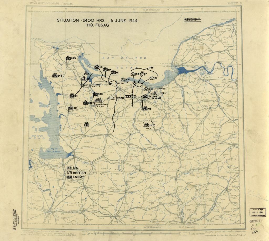
This project is to extract, from the HQ Twelfth Army Group digitized situation maps, the estimated positions of both the Allies and German units for the time period from the D-Day on June the 6th 1944 to the VE-Day on May the 8th 1945.
The challenges are numerous … one map per day over one year … 300 to 400 units to position per map … handwritten information …
To overcome the challenges, I’m going to implement a deep learning strategy … it will be in three phases …
- First, detect and differentiate the units symbols, US, British, Canadian, German …
- Second, identify the unit identification, this one is close from the symbols …
- Third, geographically localized key points on maps and then deduce the geographic location of the detected symbols.
And then, the fourth step will be to feed the Unified Maps data base with this invaluable information
But first, thank the Library of Congress for making those maps available …
Library of Congress
World War II Military Situation Maps

This collection contains maps showing troop positions beginning on June 6, 1944 to July 26, 1945. Starting with the D-Day Invasion, the maps give daily details on the military campaigns in Western Europe, showing the progress of the Allied Forces as they push towards Germany. Some of the sheets are accompanied by a declassified “G-3 Report” giving detailed information on troop positions for the period 3 Mar. 1945-26 July 1945. These maps and reports were used by the commanders of the United States forces in their evaluation of the campaigns and for planning future strategies.
The collection consists of 416 printed maps and 115 reports, the originals of which reside in the Library of Congress’ Geography and Map Division.

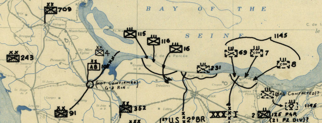
A closer examination of the unit symbols on the maps illustrates the incompleteness, uncertainty, and inaccuracies in the information caused by the fog of war available to the operational staff. Further, closer examination also yields evidence of wartime intelligence failures. For example, the vagaries in unit locations are shown by the annotation not confirmed while uncertain unit identifications are noted by ? next to the unit symbols. Significantly, these annotations were not only applied to Axis units, but were also applied to U.S. and Allied units such as the U.S. 101st Airborne Division on the June 6, 1944 map. This indicates that the operations staff was uncertain of the location of one of its own units at the end of the first day of the Normandy invasion. Equally significant are the recognizable intelligence failures evidenced by the absence of Axis unit information on key dates. One example is the Ardennes Forest area that was devoid of Axis units opposing the U.S. forces on the December 15, 1944 map. This map is clear evidence of Allied intelligence’s failure to identify Axis units before the Battle of the Bulge. Also, as the Battle of the Bulge developed and Allied intelligence improved, many previously unidentified Axis units start appearing on the situation maps. Whether viewed in its entirety or as single sheets, the Twelfth Army Group situation map collection is an excellent historical resource.
First thought
Machine learning and deep learning were totally new to me when starting the project … I had no idea about the technologies and tools to use … I was a lost … found books and tutos … and after some time back and force, I did some arbitrary choices to get some experience first … Being from the embedded SW dev world, I also wanted to learn about the real time deep learning and then I started, blindly, with Yolo, first v3 and then v4.
I had in mind the rough part would be to differentiate the unit symbol detection on the map, but it appears that detecting the unit identification number next to the symbol was the more difficult.
Unit Symbol
On the maps, the units can be identified roughly as follows …
- The type
- The infantry unit (division or regiment like)
- The armored unit (division or regiment like)
- The paratrooper unit (division or regiment like)
- The Army corp
- The Army
- The Army Group
- The country
- Germany Wehrmacht
- Germany SS
- USA
- Great Britain
- Canada
- France, Poland, …
Aggregating the division and regiment like, Canada, France, Poland … with Great Britain or USA and SS to Wehrmacht … We get around 20 classes to detect on each map
Unit identification numbers
They are located at the right side of the symbol !!! invaluable information !!!